


GIS4Mobile app for iPhone and iPad
Developer: GIS4Mobile ApS
First release : 06 Feb 2016
App size: 56.59 Mb
Recording is rewarding.
When you use GIS4Mobile you will get a complete and updated documentation, collected on site by professionals in the field.
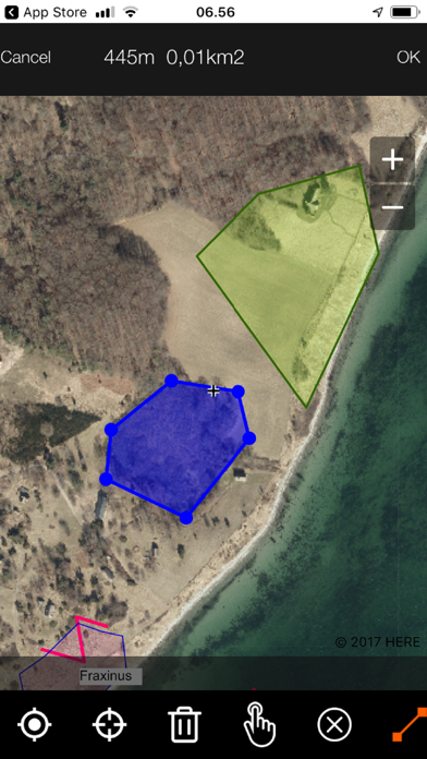
GIS4Mobile is the most flexible and userfriendly way to do inspections, documentation, data-collections and registration in the field.
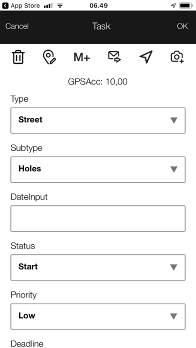
You can set it up to use one of many templates, or you can design forms youself.
While collecting data you will appreciate the utilities where the app will allow you to reuse datasets you entered earlier. So if you for instance need to register several similar lightpoles you can store all attributes in memory, so you do not need to enter the same data again and again.
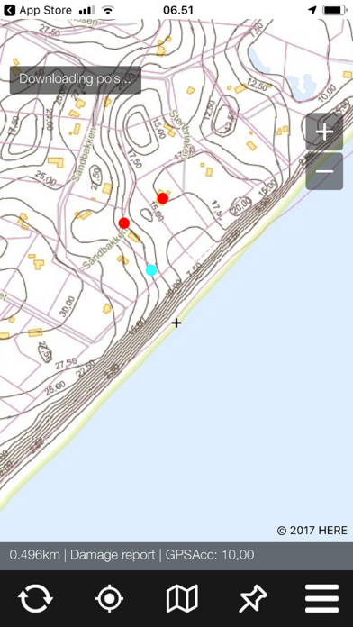
If you do inspections, you can edit several registrations in one click. First select one or more pins on the map, and then edit information for all the selected items.
This is extremely timesaving.
Data you collect is stored in the GIS4Mobile cloud.
If you have a private data storage you can publish existing datasets, and configure forms and guidelines for collecting data or editing data. Forms can contain elements a textboxes, date/time pickers, dropdown lists, checkboxes and more.
Get the app now - it is free. In the app choose free usage or connect your private storage by entering name and password.
If you choose the free usage the app will ask you to enter your name and email. The purpose of this is for GIS4Mobile to be able to contact you if you try and register faulty data and alert you when the free usage expires.
And remember - getting help from GIS4Mobile is free of charge. Just contact us.
GIS4Mobile Terms of are listed here: https://www.gis4mobile.com/legal-stuff/